| |
|
|
Exhibits:
Lea Valley - Batford, Herts |
 |
Intro
: Gallery : The
Sluice : Leasey
Bridge : Thatching
: The Lea
Plank
Bridge : Winter
Scene : Stepping
Stones : The
Gibraltar
Footbridge
: Two Willows |
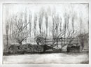
The
ten Batford etchings illustrated here as exhibits are approximately
A4 size (280 X 200mm) and are based on drawings made close to the
artist’s home, where the River Lea passes through Batford within
the Eastern boundary of Harpenden in Hertfordshire.
The Lea is a major tributary of the Thames. It is about 50 miles long
and rises on the outskirts of Luton at Leagrave, which was first settled
about 3,000 BC.
Here 10 miles downstream the river runs through the Batford Springs
Nature Reserve, an attractive area of 4 acres which includes mixed
woodland with magnificent willows and black poplars. On the west bank
are disused watercress beds which were cultivated through the first
half of the twentieth century. Pumps operated on 5 bore holes of up
to 120 feet deep to raise water at a rate of 4,000 gallons/hour, so
maintaining a constant depth of 3-4 inches; the bore holes are now
silted up.
Batford Springs lies on the Lea Valley Walk www.leevalley-online.co.uk
Hereabouts the walk follows the line of the pre-Beeching single track
railway that linked Luton and Hatfield. This line passed through three
intermediate stations at Wheathampstead, Harpenden (East) and New
Mill Road. In 1864 one could have taken the 08.20 from Harpenden to
arrive at Kings Cross at 09.37.
The walk to Batford from Wheathampstead passes Castle Farm on the
site of a castle occupied in 1277 by John de Laycestria, vicar of
Wheathampstead. Batford Mill is mentioned in the Doomsday Book, today
it is a tidy group of small industrial units. The busy B 653 links
to junction 4 of the A1 M to the east and to Luton in the west.
|
|
|